Skip to product information
1 of 11

One of Seven

2025 TOUR DIVIDE PLANNING AIDS

2025 TOUR DIVIDE PLANNING AIDS

Regular price $25.00 USD
Regular price Sale price $25.00 USD
Sale Sold out
Route Options


TOUR DIVIDE PLANNING AIDS

The 2025 Tour Divide Planning Aids are the ultimate resource for conquering the Tour Divide. Designed specifically for this iconic bikepacking route, these planning aids simplify planning, keep you organized, and ensure you're prepared for the challenges ahead.

Choose the Small Bundle to get our two most popular planning aids, the Data Sheet and Town List. The Big Bundle includes all four of our planning aids: the Data Sheet, Town List, Mileage Chart, and Elevation Gain Chart.

Whether you're meticulously planning beforehand or referencing details on-route, these comprehensive resources provide the data and insights you need for a successful ride.

Highlights include:

  • Southbound (SOBO) and Northbound (NOBO) formats to match your direction.
  • Available in US Standard and Metric units, catering to your preference.
  • Accurate Route Details: Covers mileage, elevation profiles, and key POIs specific to the Tour Divide route—not the ACA'S GDMBR.
  • Actionable Insights: Features cumulative distances, elevation gains, water sources, bike shops, resupply options, and critical notes to keep you on track.
  • Delivered as PDF files, non-editable for consistency across devices.
  • $1.00 from every sale supports the bikepacking community via BikepackingRoots.com.

With these Planning Aids, you’ll have everything you need to stay focused on the ride, not the logistics—before, during, and after your Tour Divide adventure.


    Key Features

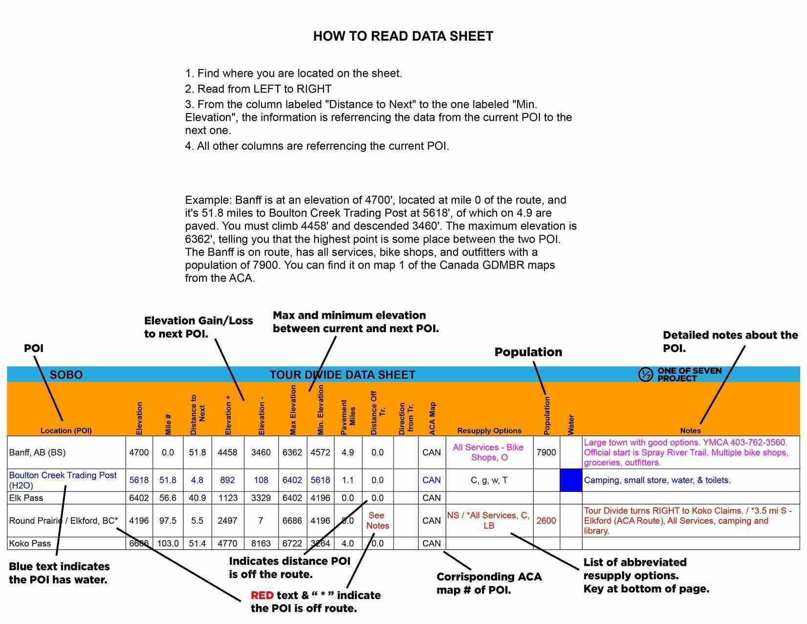
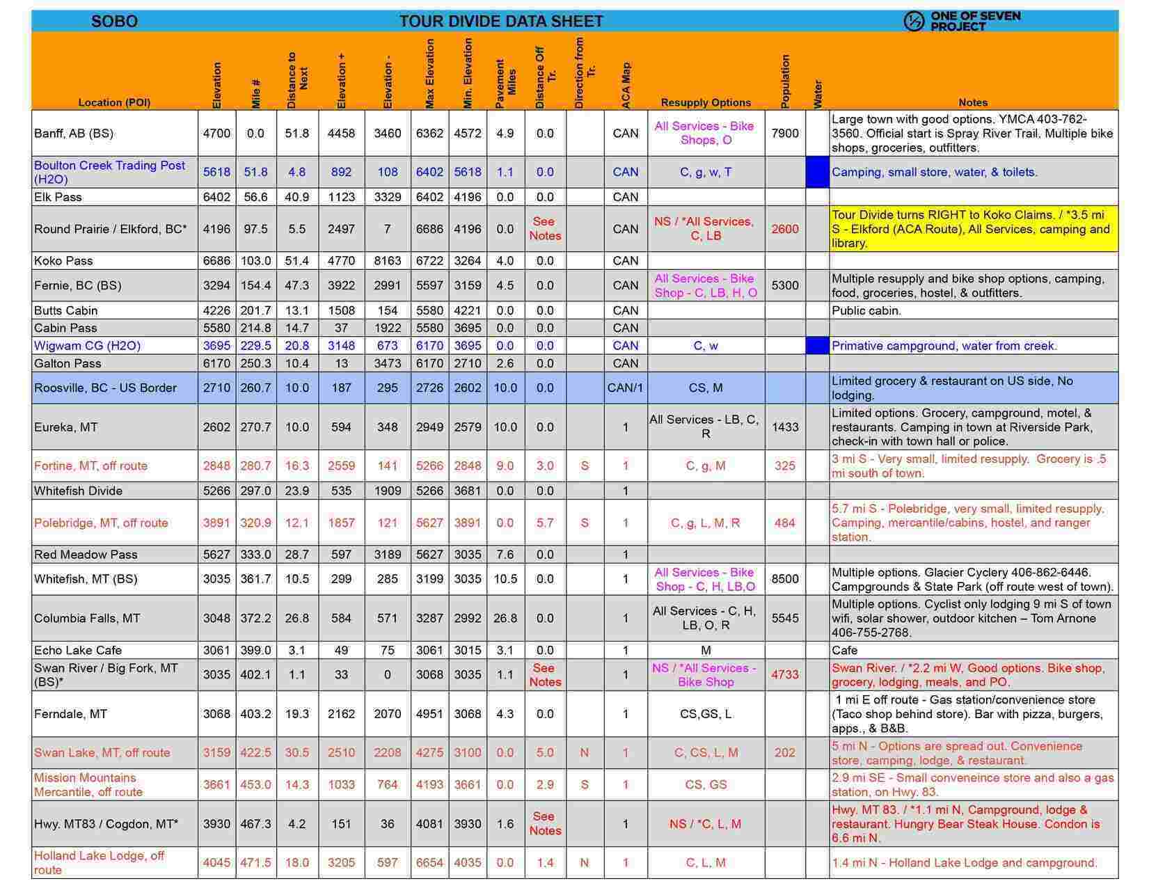
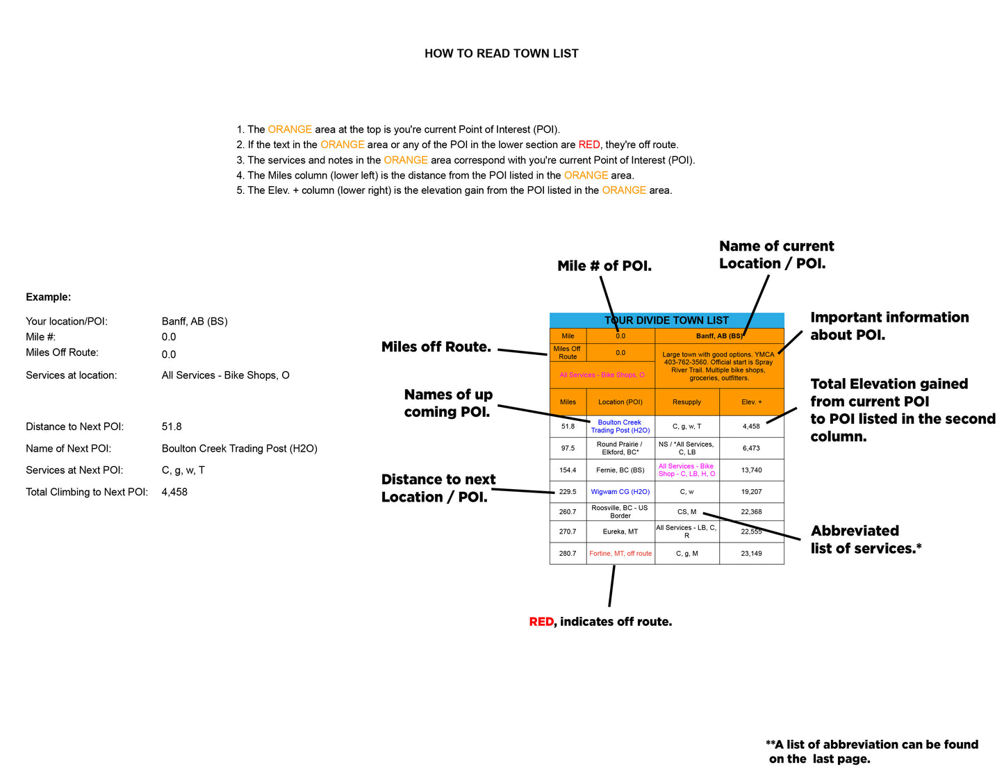
    The 2025 Tour Divide Planning Aids provide riders with an unmatched level of detail, covering every aspect of the route to simplify planning and ensure success. Key features include:

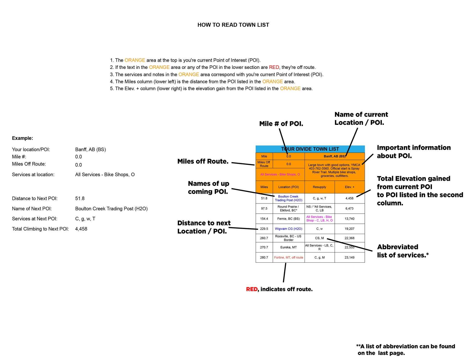
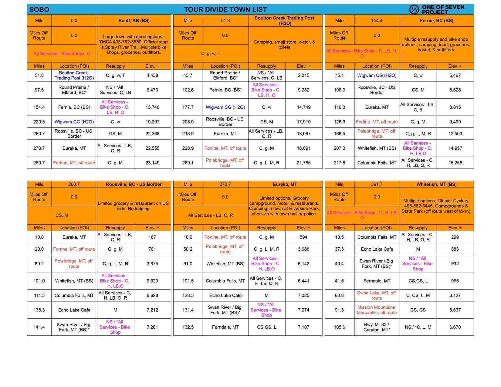
    Detailed Point-of-Interest (POI) Data:

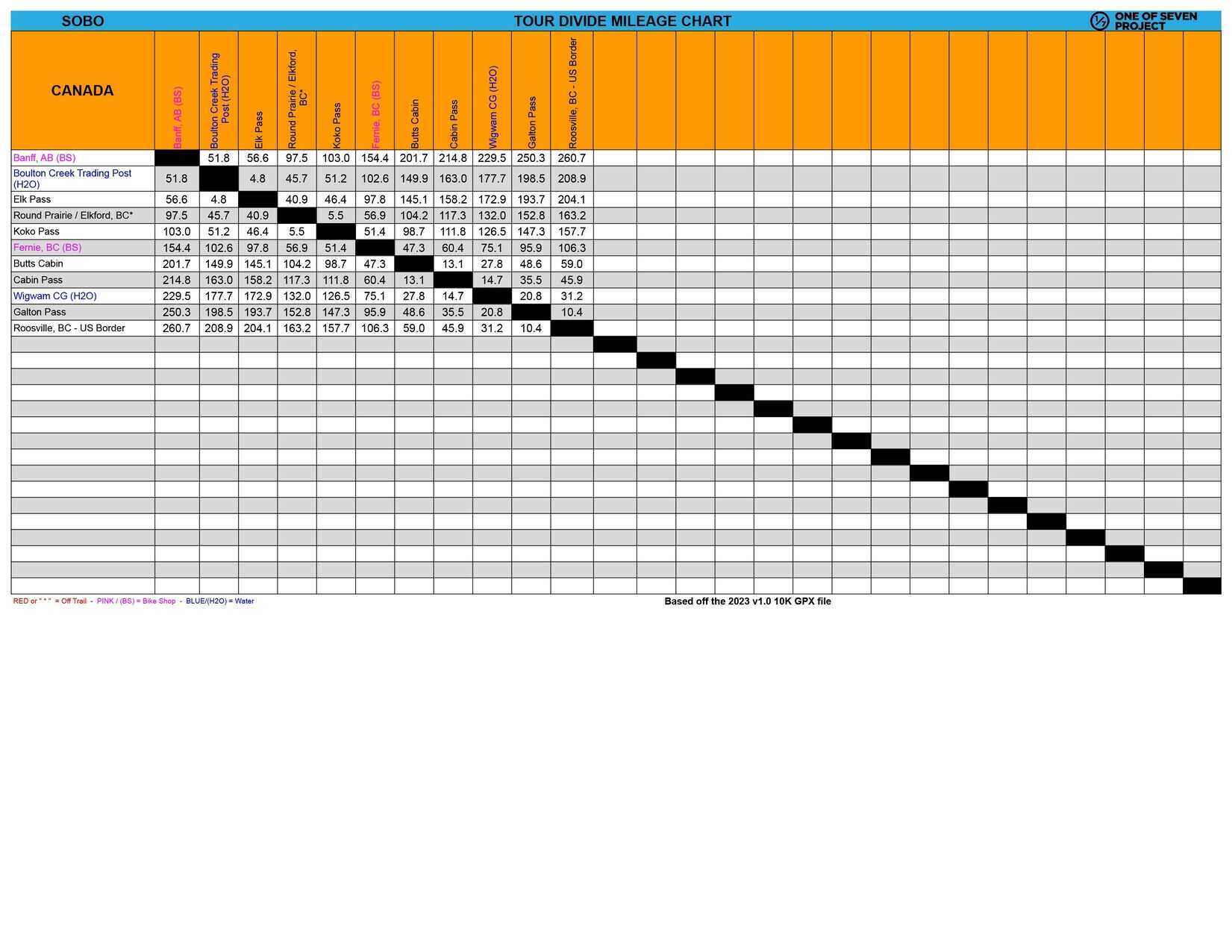
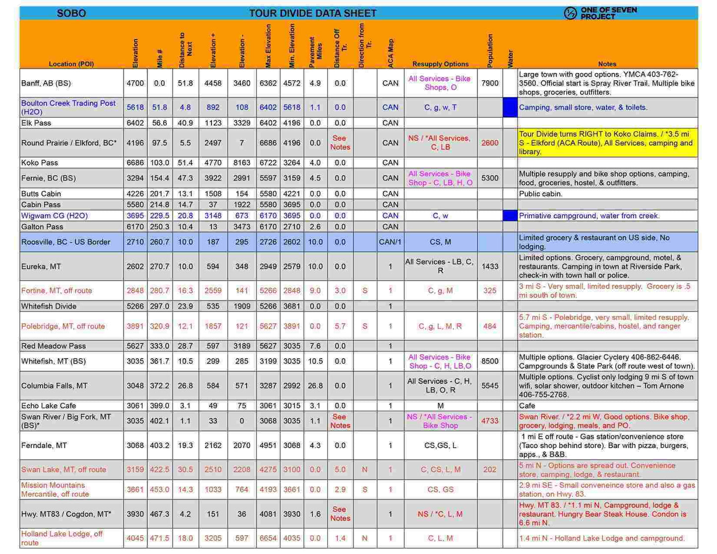
    Key POIs with mileage numbers, elevation profiles, and cumulative distances to the next stops.

    Comprehensive resupply options, including bike shops, water sources, and grocery stores.

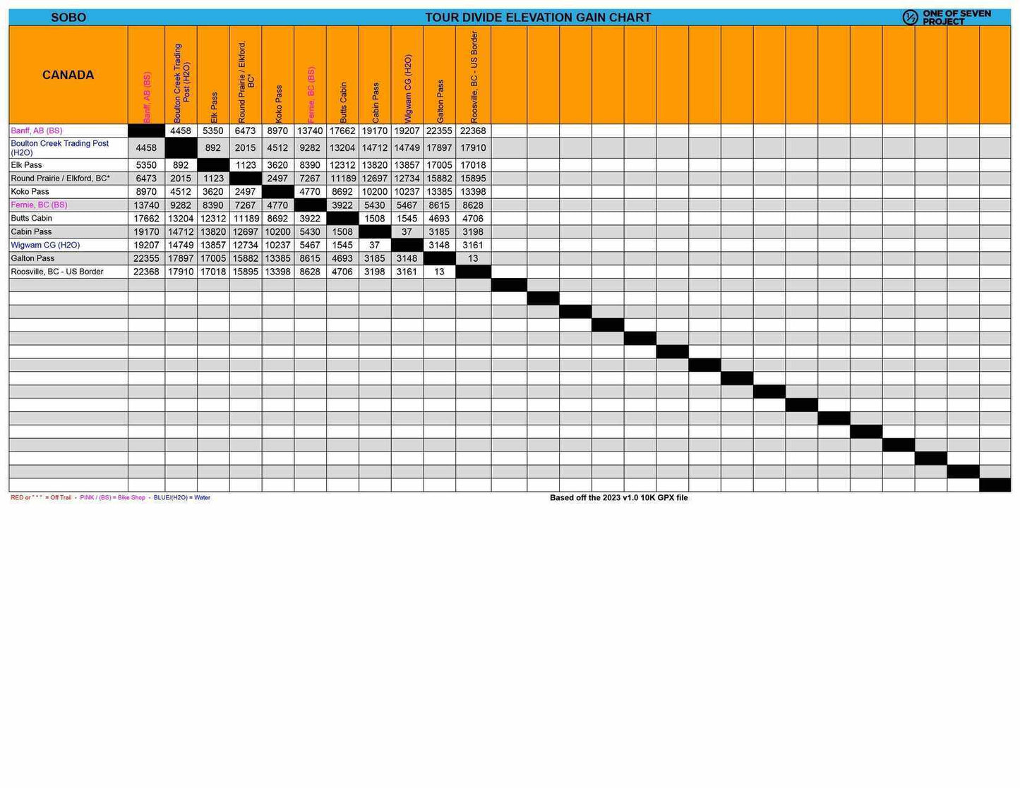
    Route-Specific Metrics:

    Elevation gain/loss (+/-), max/min elevations, and pavement mileage help riders plan for varying terrain.

    Elevation profiles offer a visual guide to upcoming climbs and descents.

    Practical Planning Tools:

    Important notes for navigating challenging sections or remote areas.

    Finish target times to help riders set realistic goals for daily progress.

    Versatile and Reliable:

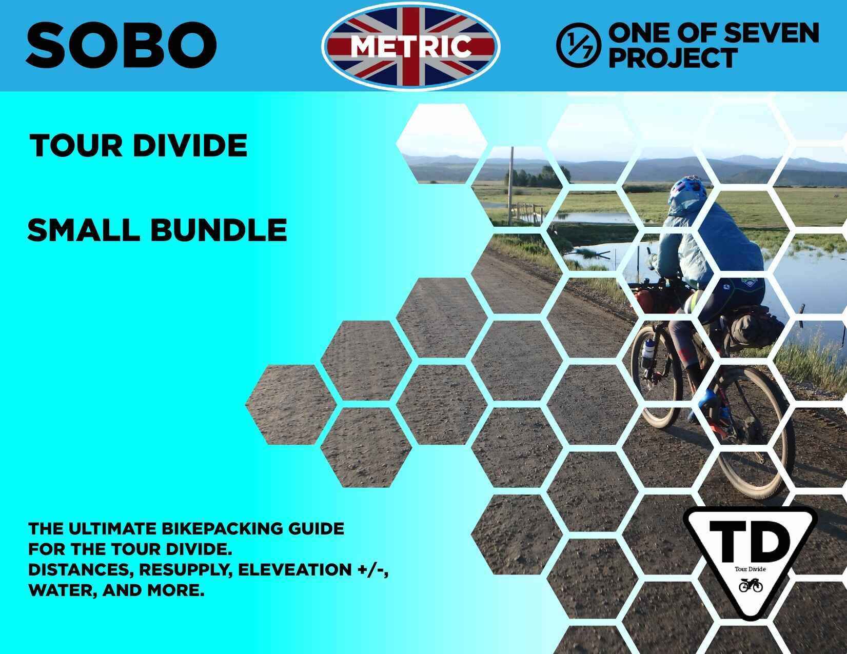
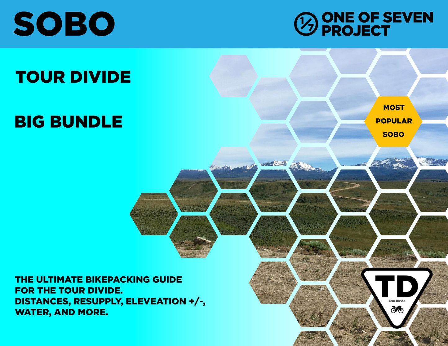
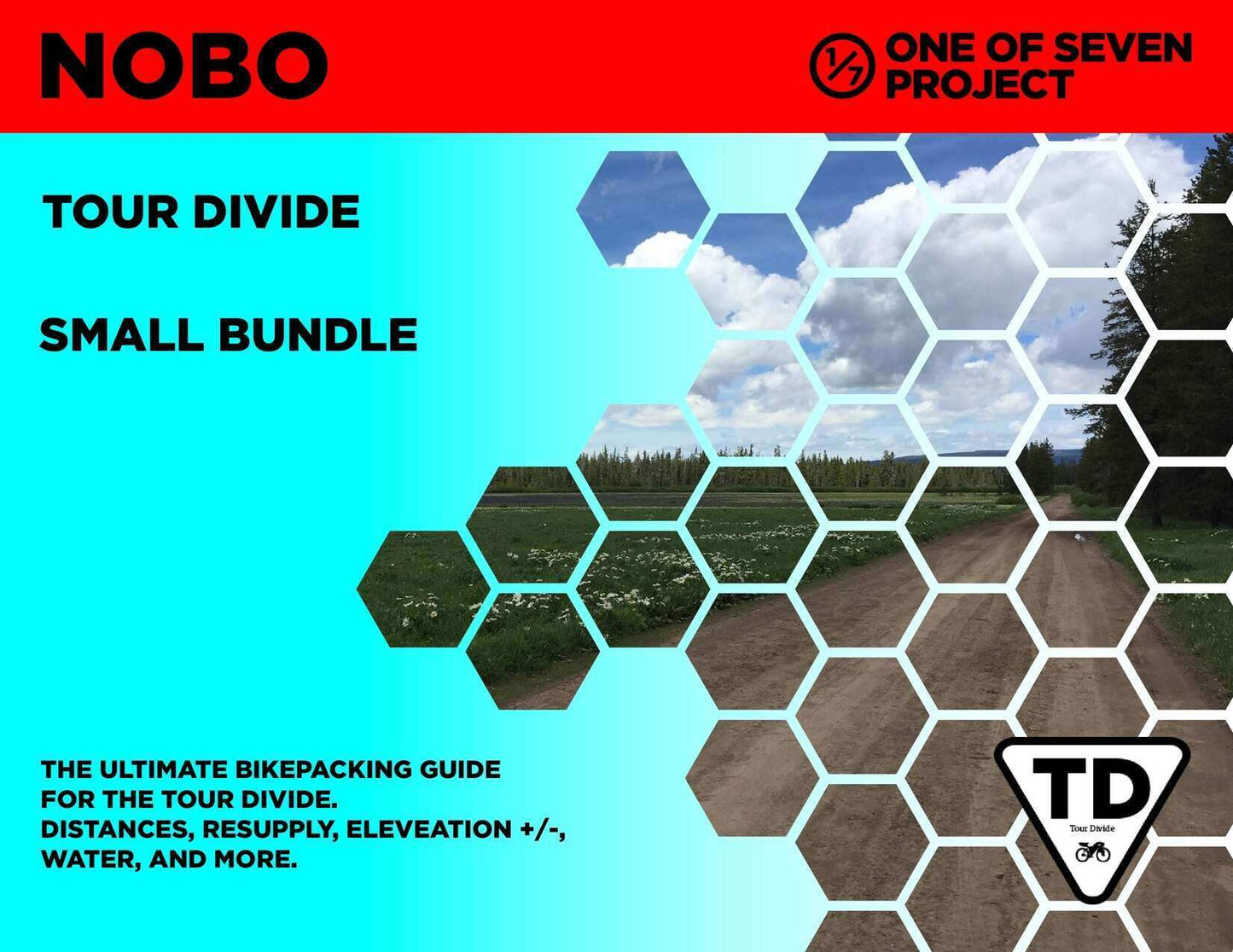
    Available in SOBO and NOBO formats.

    Offered in US Standard and Metric units for universal accessibility.

    Delivered as PDF files—non-editable for ease of use across devices.

    Differences between Planning Aids

    Data Sheet: The ultimate resource for granular details between POIs. Includes distance, elevation gain/loss, max/min elevations, pavement sections, bike shops, resupply points, water sources, references to the ACA maps, and critical notes. Ideal for precise planning and on-route reference. Example: Covers A to B, then B to C, and so on.

    Town List: Provides cumulative distances, elevation gains/losses, and resupply points for each POI, saving you time and effort. Helps you avoid complex calculations to determine distances, elevation gains, and losses between multiple POI. Example: Covers A to B, A to C, A to D; the next section would include B to C, B to D, B to E, and so on. Available in Small and Big Bundles only.

    Mileage Chart: Quickly locate the total mileage between any two POIs on the route. A convenient way to plan long days or calculate progress. Sold exclusively in the Big Bundle.

    Elevation Gain Chart: Visualize total elevation gain between POIs to prepare for climbs and descents. A must-have for pacing your ride. Sold exclusively in the Big Bundle.

    Updates / Expiration

    View full details