
One of Seven
2025 KOKOPELLI TRAIL
2025 KOKOPELLI TRAIL
Couldn't load pickup availability
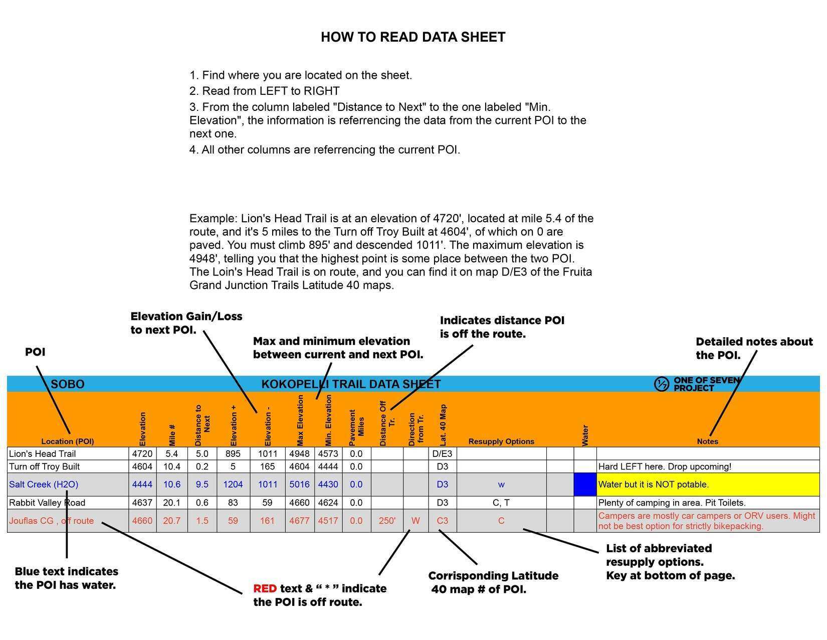
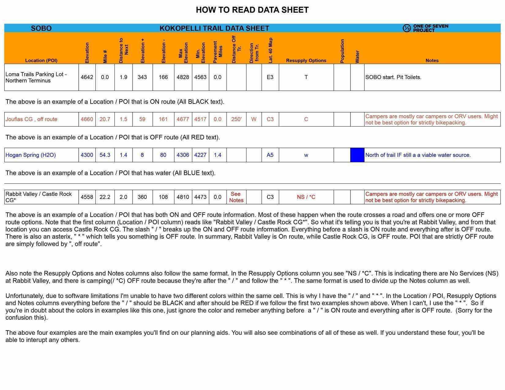
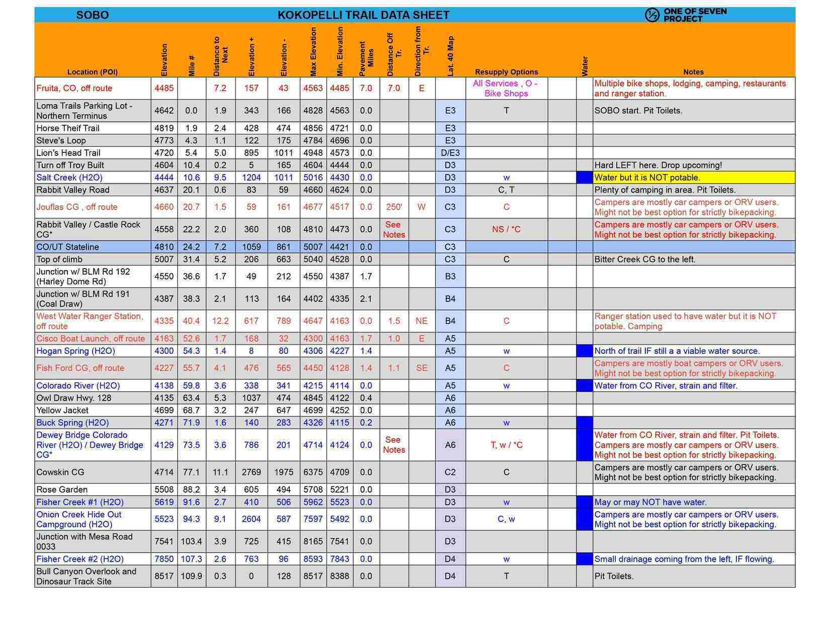
KOKOPELLI TRAIL PLANNING AIDS
Your Ultimate Guide to the Kokopelli Trail Adventure
Prepare for an unforgettable journey along the Kokopelli Trail with our 2025 Planning Aids. Designed specifically for this rugged, diverse bikepacking route, these resources simplify your planning and keep you organized so you can focus on the adventure ahead.
Whether you're preparing in advance or referencing vital details along the way, these comprehensive guides provide the essential information for a successful ride.
Highlights include:
- Southbound (SOBO) and Northbound (NOBO) formats to suit your direction of travel.
- Available in US Standard units to match your preference.
- Accurate Route Details: Covers mileage, elevation profiles, and key POIs specific to the Kokopelli Trail, not other routes.
- Actionable Insights: Includes cumulative distances, elevation gains, water sources, bike shops, resupply points, and critical notes to keep you on track.
- Delivered as PDF files, non-editable for consistency across all devices.
- $1.00 from every sale goes to support the bikepacking community through BikepackingRoots.com.
With these Planning Aids, you’ll have all the tools to stay focused on the ride, not the logistics—before, during, and after your Kokopelli Trail adventure. Get ready to hit the trail with confidence!
Key Features
Key Features
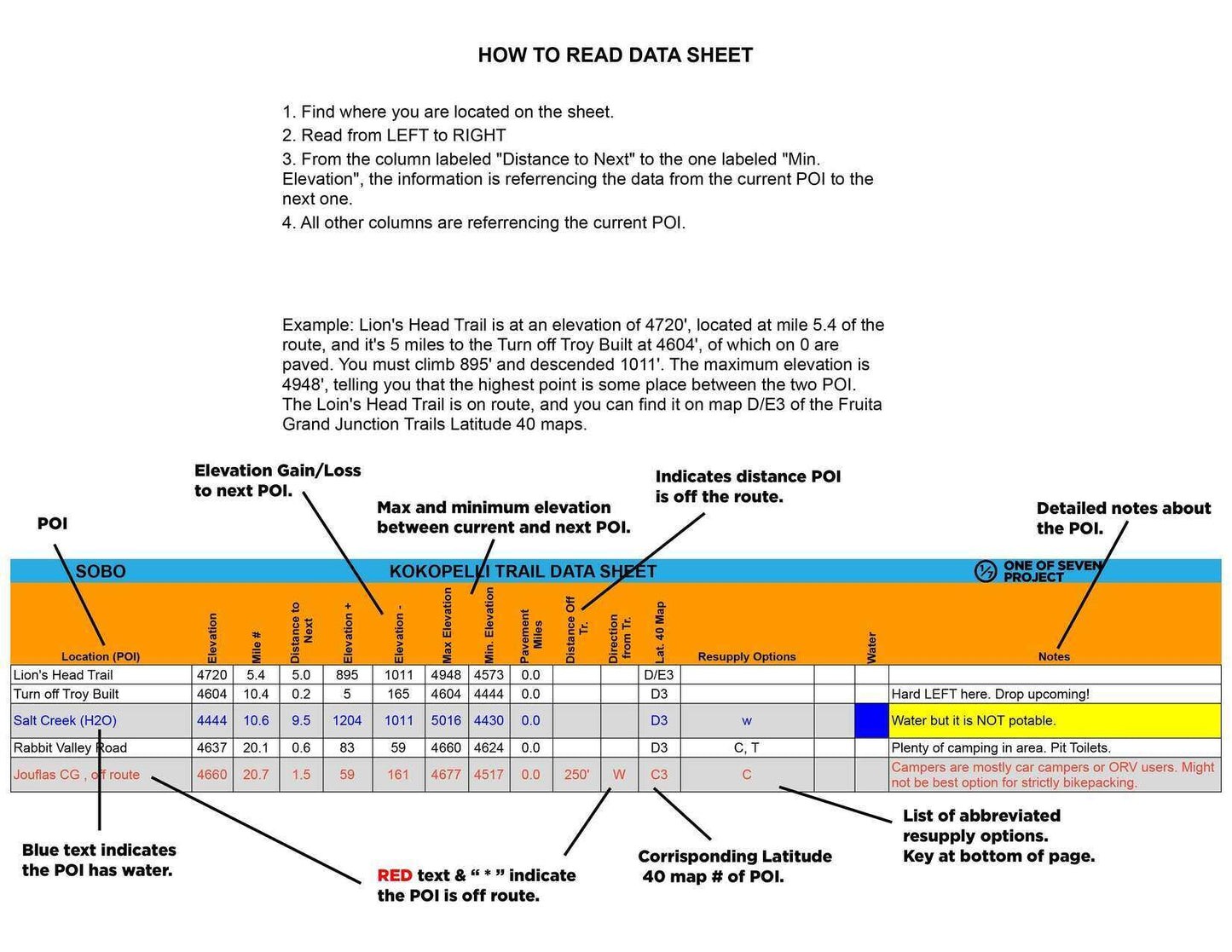
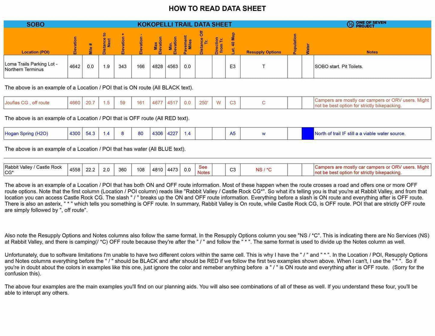
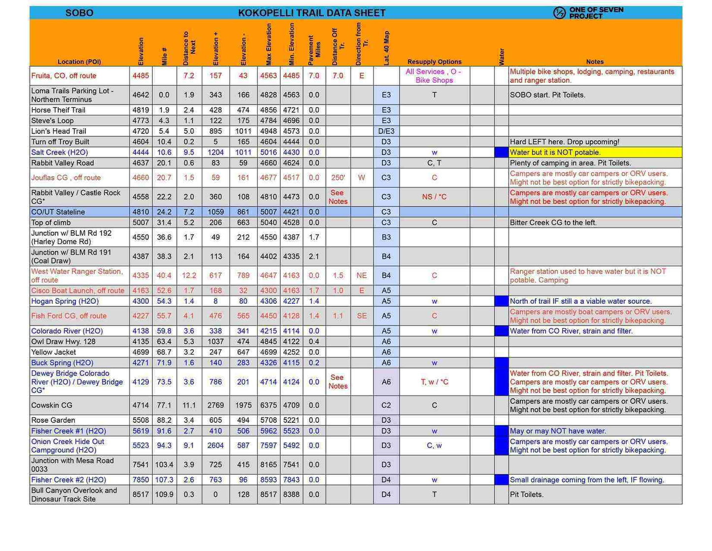
The 2025 Kokopelli Trail Planning Aids are designed to provide bikepackers with everything needed to confidently tackle this challenging route, offering in-depth data for successful navigation and preparation. Key features include:
Detailed Point-of-Interest (POI) Data:
Critical POIs with mileage, elevation profiles, and cumulative distances to help track your progress.
Extensive resupply information, including bike shops, water sources, and grocery stores, ensuring you're never caught off-guard.
Route-Specific Metrics:
Elevation gain/loss (+/-), max/min elevations, and pavement mileage, allowing bikepackers to anticipate the challenges of the trail’s varied terrain.
Elevation profiles to visually map out upcoming climbs, descents, and sections with significant elevation changes.
Practical Planning Tools:
Finish target times to help bikepackers set realistic daily progress goals based on terrain and distance.
Versatile and Reliable:
Available in both Southbound (SOBO) and Northbound (NOBO) formats to suit your travel direction.
Offered in US Standard units for broader accessibility.
Delivered as PDF files, ensuring ease of use on all devices with a non-editable format for reliability.
Differences between Planning Aids
Differences between Planning Aids
Since the Kokopelli Trail Planning Aids are only available in the Data Sheet format only, we suggest checking out the Key Features section for a detailed overview of what’s included in this resource.
Updates / Expiration
Updates / Expiration
Updates
The 2025 Planning Aids reflect the most current data for the Kokopelli Trail. They are based on the latest 10k GPX file and will be updated to incorporate any new information as it becomes available. Your purchase includes free updates throughout the 2025 season, and you will receive an email notification whenever an update is made.
Expiration
After December 31, 2025, these Planning Aids will no longer be updated or supported.