


One of Seven
2025 CTR PLANNING AIDS
2025 CTR PLANNING AIDS
Couldn't load pickup availability
CTR PLANNING AIDS
The Colorado Trail Race Planning Aids are your ultimate companion for navigating the stunning Colorado Trail. These planning aids are designed to simplify your preparation, keep you organized on the trail, and ensure you're ready for the challenges the trail offers.
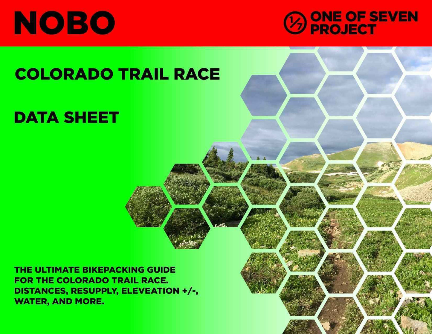
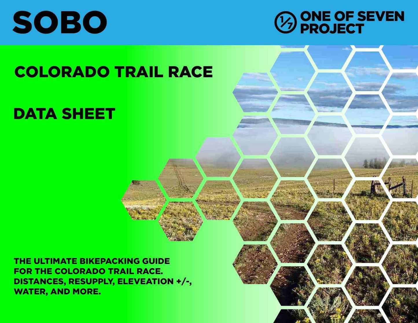
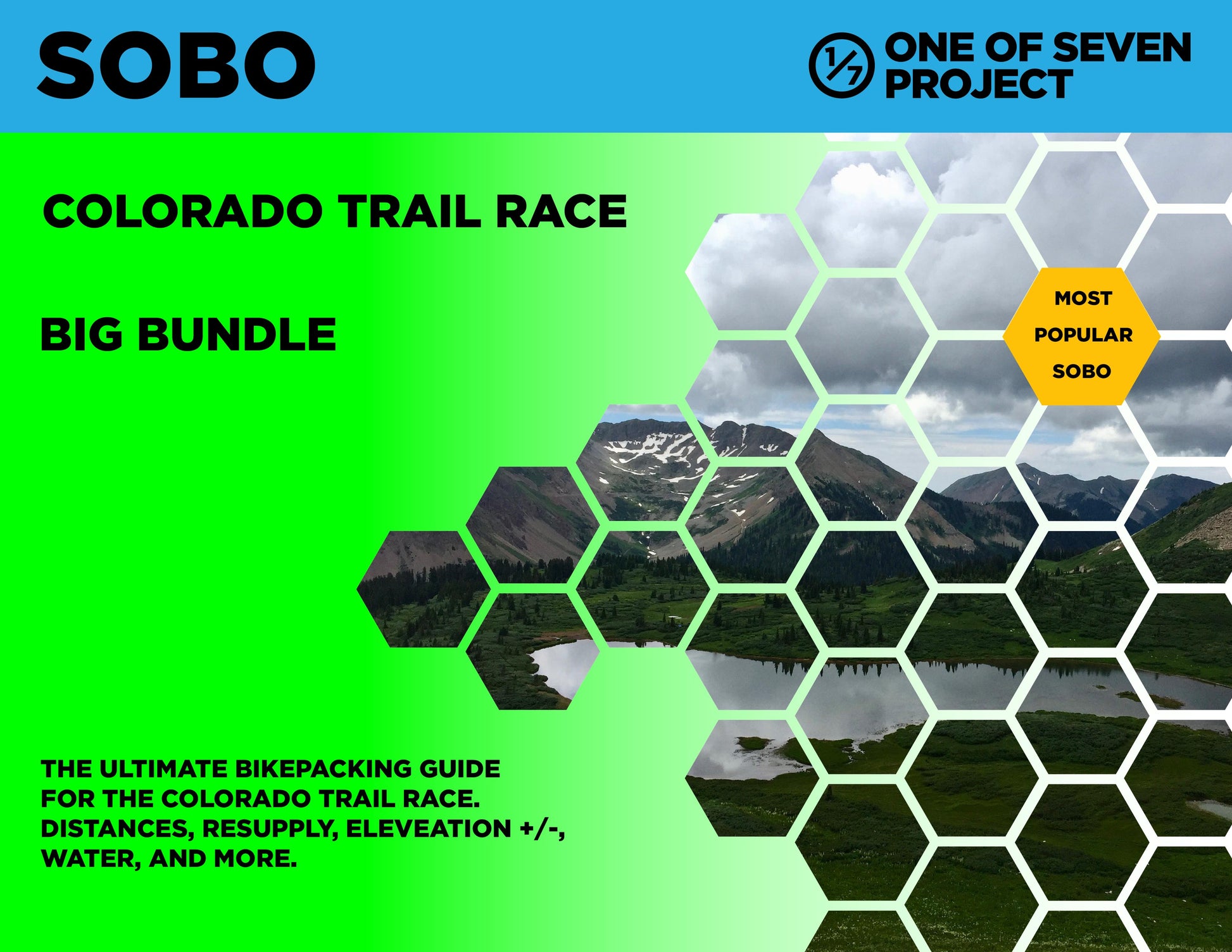
Choose the Small Bundle to get our two most popular planning aids, the Data Sheet and Town List. The Big Bundle includes all four of our planning aids: the Data Sheet, Town List, Mileage Chart, and Elevation Gain Chart.
Whether you're planning your trip in advance or need quick access to critical information on the trail, these comprehensive resources provide everything you need for a successful ride.
Highlights include:
- NOBO and SOBO formats to match your preferred direction.
- Available in US Standard units for consistent measurements and ease of use.
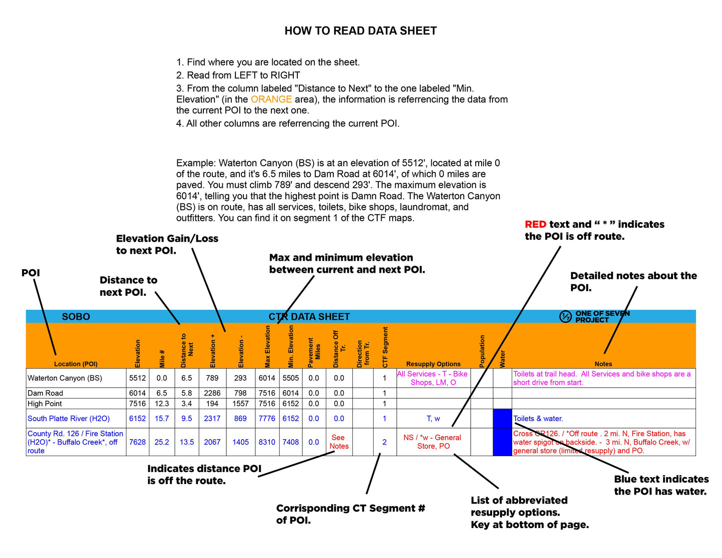
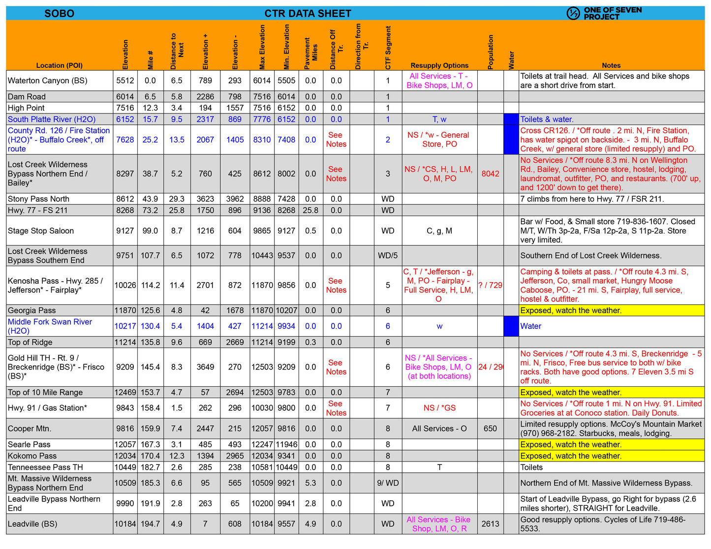
- Accurate Route Details: Covers mileage, elevation profiles, and key points of interest (POIs) specific to the Colorado Trail route, with references to the Colorado Trail Foundation (CTF) segments.
- Actionable Insights: Includes resupply points, water sources, bike shops, and critical notes to keep you on track. We also highlight high-altitude sections, ensuring you're prepared for any challenging weather.
- Delivered as PDF files: Non-editable, ensuring consistency across all devices.
- $1.00 from every sale supports the Colorado Trail Foundation, helping preserve and improve this amazing trail.
These Planning Aids provide everything you need to stay focused on the ride, not the logistics—before, during, and after your Colorado Trail adventure.
Key Features
Key Features
The 2025 Colorado Trail Race Planning Aids provide riders with an unmatched level of detail, covering every aspect of the route to simplify planning and ensure a successful adventure. Key features include:
Detailed Point-of-Interest (POI) Data:
- Key POIs with mileage numbers, elevation profiles, and cumulative distances to the next stops.
- Comprehensive resupply options, including bike shops, water sources, and grocery stores.
Route-Specific Metrics:
- Elevation gain/loss (+/-), max/min elevations, and pavement mileage help riders plan for varying terrain.
- Elevation profiles offer a visual guide to upcoming climbs and descents.
Practical Planning Tools:
- Important notes for navigating challenging sections, high-altitude areas, and remote locations.
- Finish target times to help riders set realistic goals for daily progress.
Versatile and Reliable:
- Available in SOBO and NOBO formats.
- Offered in US Standard units for universal accessibility.
- Delivered as PDF files—non-editable for ease of use across devices.
Differences between Planning Aids
Differences between Planning Aids
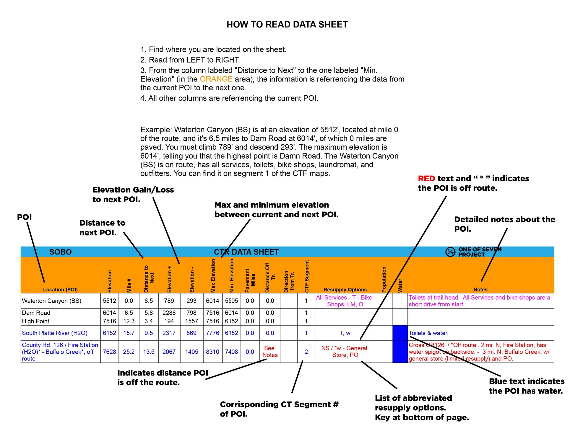
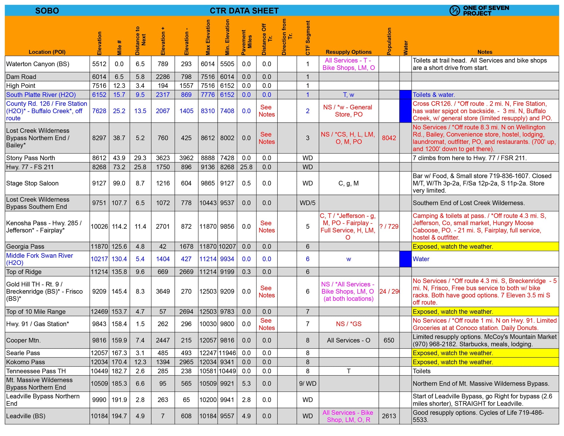
Data Sheet:
The ultimate resource for granular details between POIs. Includes distance, elevation gain/loss, max/min elevations, pavement sections, bike shops, resupply points, water sources, references to the CTF segments, and critical notes. Ideal for precise planning and on-route reference. Example: Covers A to B, then B to C, and so on.
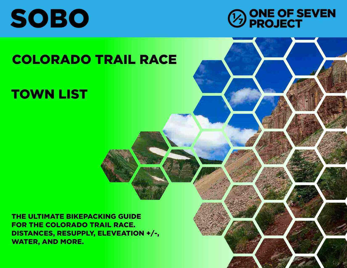
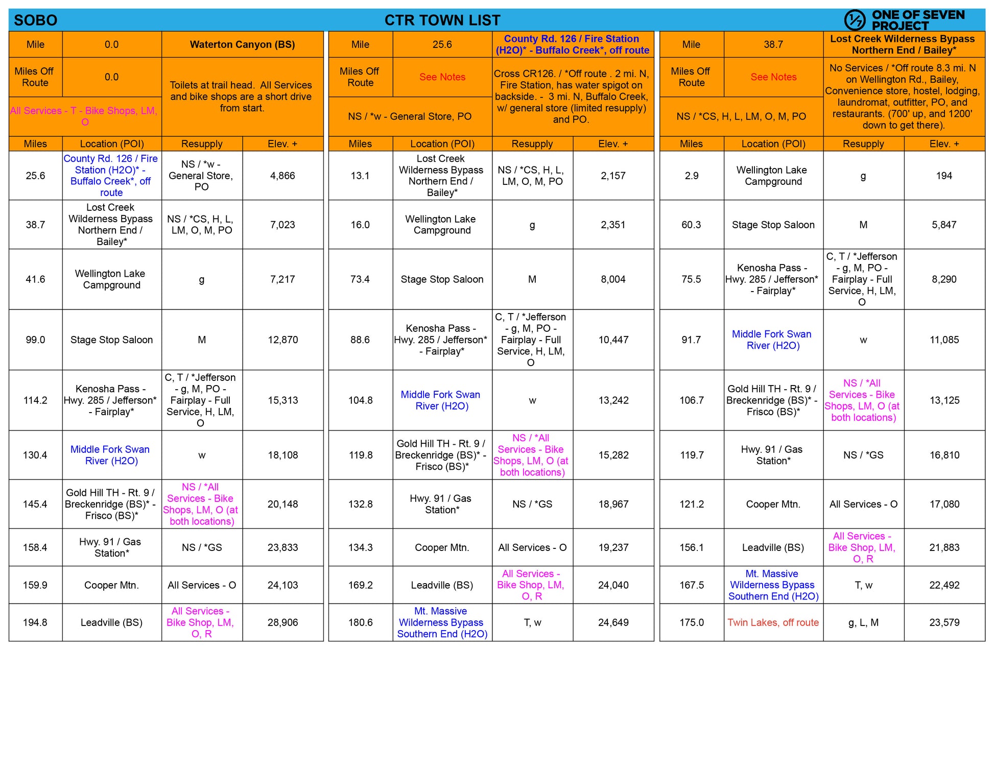
Town List:
Provides cumulative distances, elevation gains/losses, and resupply points for each POI, saving you time and effort. Helps you avoid complex calculations to determine distances, elevation gains, and losses between multiple POI. Example: Covers A to B, A to C, A to D; the next section would include B to C, B to D, B to E, and so on. Available in Small and Big Bundles only.
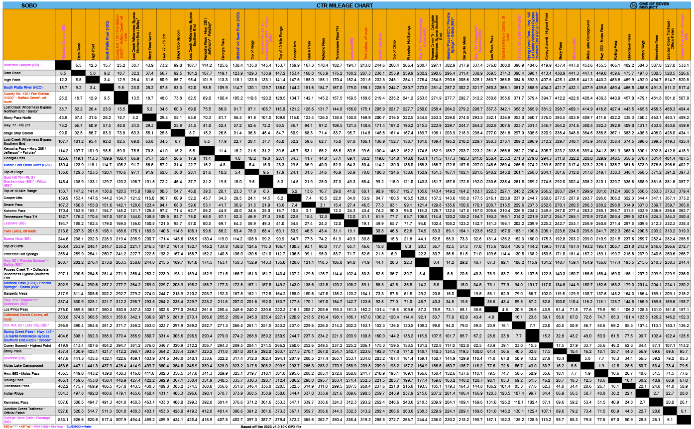
Mileage Chart:
Quickly locate the total mileage between any two POIs on the route. A convenient way to plan long days or calculate progress. Sold exclusively in the Big Bundle.
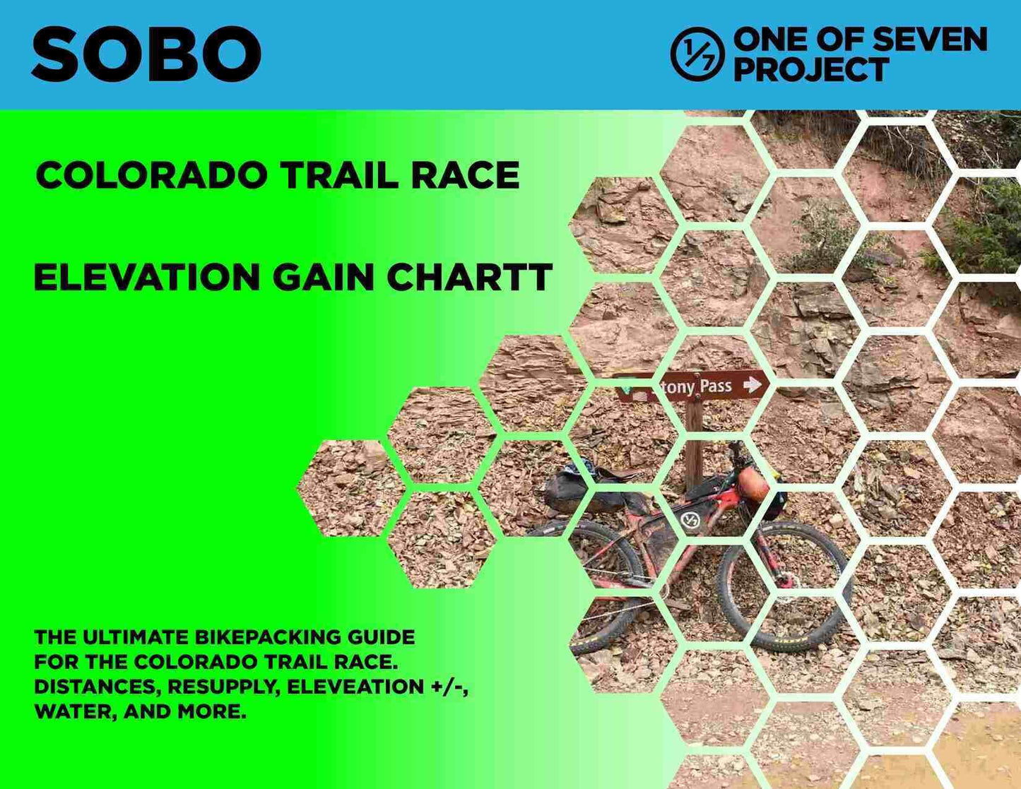
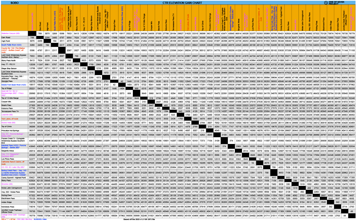
Elevation Gain Chart:
Visualize total elevation gain between POIs to prepare for climbs and descents. A must-have for pacing your ride. Sold exclusively in the Big Bundle.
Updates / Expiration
Updates / Expiration
Updates
The 2025 Planning Aids reflect the most current data for the Colorado Trail Race. They are based on the latest 10k GPX file and will be updated to incorporate any new information as it becomes available. Your purchase includes free updates throughout the 2025 season, and you will receive an email notification whenever an update is made.
Expiration
After December 31, 2025, these Planning Aids will no longer be updated or supported.